

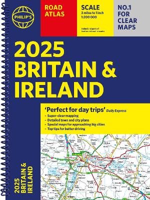
2025 Philip's Road Atlas Britain and Ireland: (A4 Spiral Binding)
Regular price
€21.99
Sale price
€21.99
Unit price
/
per
Tax included.
Shipping calculated at checkout.
<p><b>'Good balance between detail and clarity with excellent town maps' </b><i><b>What Car?</b></i><br /><b>PHILIP'S - Market leader and No. 1 in the UK for clear maps </b><i>2025 Philip's Road Atlas of Britain and Ireland </i>is a top-of-the-range, A4-sized, spiral-bound atlas, featuring fully updated maps from the Philip's digital database. Voted Britain's clearest and most detailed in an independent consumer survey, the mapping is super-clear.<br /><br />* 160 pages of fully updated super-clear road maps<br />* Top tips for better and safer driving and the easiest way to parallel park <br />* Detailed route-planning maps, to help plan your route in advance<br />* 88 fully indexed and detailed town-centre maps throughout the British Isles<br />* Major city approach maps with named arterial roads including the expanded London ULEZ<br />* Clear road map showing all of Ireland <br /><b>*</b> Mapping at a scale of 3 miles to 1 inch = 1:200,000 for easy use<br /><b>* </b>Handy lie-flat spiral format<br /><br />This atlas contains 160 pages of road maps covering Britain at 3 miles to 1 inch, with the Western Isles, Orkney and Shetland at smaller scales. The maps clearly mark service areas, roundabouts and multi-level junctions, and in rural areas distinguish between roads over and under 4 metres wide.It also includes a 2-page road map of Ireland, 10 pages of route-planning maps, a distance table, 10 large-scale city approach maps with named arterial roads, and 88 extra-detailed and fully indexed town and city plans. <br /><br />Wherever you are driving in Britain and Ireland, this is the ultimate road trip guide.</p>
Spiral bound | 256 pages | Published June 2024
READ MORE
<p><b>'Good balance between detail and clarity with excellent town maps' </b><i><b>What Car?</b></i><br /><b>PHILIP'S - Market leader and No. 1 in the UK for clear maps </b><i>2025 Philip's Road Atlas of Britain and Ireland </i>is a top-of-the-range, A4-sized, spiral-bound atlas, featuring fully updated maps from the Philip's digital database. Voted Britain's clearest and most detailed in an independent consumer survey, the mapping is super-clear.<br /><br />* 160 pages of fully updated super-clear road maps<br />* Top tips for better and safer driving and the easiest way to parallel park <br />* Detailed route-planning maps, to help plan your route in advance<br />* 88 fully indexed and detailed town-centre maps throughout the British Isles<br />* Major city approach maps with named arterial roads including the expanded London ULEZ<br />* Clear road map showing all of Ireland <br /><b>*</b> Mapping at a scale of 3 miles to 1 inch = 1:200,000 for easy use<br /><b>* </b>Handy lie-flat spiral format<br /><br />This atlas contains 160 pages of road maps covering Britain at 3 miles to 1 inch, with the Western Isles, Orkney and Shetland at smaller scales. The maps clearly mark service areas, roundabouts and multi-level junctions, and in rural areas distinguish between roads over and under 4 metres wide.It also includes a 2-page road map of Ireland, 10 pages of route-planning maps, a distance table, 10 large-scale city approach maps with named arterial roads, and 88 extra-detailed and fully indexed town and city plans. <br /><br />Wherever you are driving in Britain and Ireland, this is the ultimate road trip guide.</p>
Barcode: 9781849076685
Spiral bound | 256 pages | Published June 2024
Share
Loading locations...
files/9781849076685.jpg
05:45 AM
Note
Items with stock in stores will be delivered within 2-3 days. Items from the warehouse will take 5-10 Working Days
You Also Viewed
-
Satisfaction Guaranteed
-
Customer Care
-
Easy Returns
-
Free Shipping Over €100

2025 Philip's Road Atlas Britain and ...
Regular price
€21.99
Sale price
€21.99
Unit price
/
per