Skip to product information

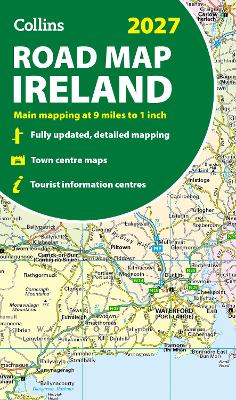
Collins Road Map of Ireland 2027 (Folded map): Clear, easy-to-read mapping (Collins Road Atlas)

Regular price €9.99
Sale price €9.99
Tax included. Shipping calculated at checkout.

Explore Ireland with easy-to-read mapping from Collins.

Full-colour map of Ireland at 9 miles to 1 inch (1:570,240), with clear, detailed road network and counties and new administrative areas shown in colour. This double-sided map covers the whole of Ireland, and is ideal for reference or route planning.

This map of Ireland shows the road network in detail. It is ideal for business users, with colouring of local council areas, but it is also perfect for tourists as a route planning map.

Main features include:

  • Fully updated
  • New administrative areas shown in colour
  • Clear, detailed road network
  • Town and city names, rivers, lakes, spot heights, railway lines and canals are clearly shown
  • City/town centre street plans of Belfast, Cork, Dublin, Dun Laoghaire, Galway, Limerick, Londonderry/Derry and Waterford showing places of interest
  • Full index to place names
  • Mileage chart
  • Car ferry routes
  • Key in English, French and German

Area of coverage
Covers the whole of the Republic of Ireland and Northern Ireland

Sheet map, folded | 2 pages | Published March 2026

READ MORE

Explore Ireland with easy-to-read mapping from Collins.

Full-colour map of Ireland at 9 miles to 1 inch (1:570,240), with clear, detailed road network and counties and new administrative areas shown in colour. This double-sided map covers the whole of Ireland, and is ideal for reference or route planning.

This map of Ireland shows the road network in detail. It is ideal for business users, with colouring of local council areas, but it is also perfect for tourists as a route planning map.

Main features include:

  • Fully updated
  • New administrative areas shown in colour
  • Clear, detailed road network
  • Town and city names, rivers, lakes, spot heights, railway lines and canals are clearly shown
  • City/town centre street plans of Belfast, Cork, Dublin, Dun Laoghaire, Galway, Limerick, Londonderry/Derry and Waterford showing places of interest
  • Full index to place names
  • Mileage chart
  • Car ferry routes
  • Key in English, French and German

Area of coverage
Covers the whole of the Republic of Ireland and Northern Ireland

Sheet map, folded | 2 pages | Published March 2026

Barcode: 9780008779061
Loading locations...

You Also Viewed

  • Satisfaction Guaranteed

  • Customer Care

  • Easy Returns

  • Free Shipping Over €100

Collins Road Map of Ireland 2027 (Folded map): Clear, easy-to-read mapping (Collins Road Atlas)

Collins Road Map of Ireland 2027 (Fol...

Regular price €9.99
Sale price €9.99